views
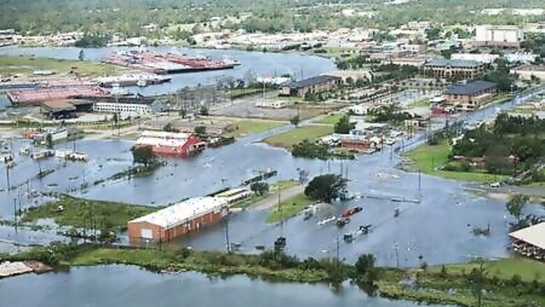
The 20-foot high “unsurvivable” wall of water Hurricane Laura was forecast to send onto the Louisiana coast showed up despite widespread reports of a lower peak, authorities said on Friday, rejecting criticism that they had raised too much alarm.
The highest surge hit about 15 miles east of where Laura was forecast to make landfall but it “wobbled” at the last moment. That slight change likely saved the city of Lake Charles, said Jamie Rhome, head of the storm surge team at the National Hurricane Center (NHC).
Most U.S. media played up a nine-foot surge recorded by a National Oceanic and Atmospheric Administration observation station near Cameron, Louisiana, and the NHC was criticized for perhaps raising too much alarm.
There is just one problem, Rhome said.
“It’s wrong. That reporting is based off a single observation station in Cameron Parish that didn’t come close to measuring the peak storm surge which occurred at 10 or 15 miles east of there,” he said.
Fresh data on Friday from an Army Corps of Engineer gauge 15 miles east indicates that the storm surge was right at the 15- to 20-feet forecast that was Rhome’s highest in his 20-year career, he said.
An exact reading would soon be released after the data and gauge are fully analyzed, Rhome said.
“We’re finding out the storm surge was really 15 to 20 feet,” Louisiana Governor John Bel Edwards confirmed to reporters on Friday after flying over the hardest-hit areas.
Rhome said it would be unfair to accuse NHC forecasters – who warned of an “unsurvivable storm surge” the day before Laura made landfall – or local and state leaders for raising alarm about storm surges. A decade ago, 50% of deaths from hurricanes were because of storm surges, he noted.
Today, that figure is closer to 4%, Rhome said, largely because the NHC started including storm surge warnings in its bulletins following the devastation brought by Hurricane Ike and its 15-foot storm surge in 2008.
TRUMP TO VISIT
The remnants of Hurricane Laura doused Arkansas on Friday before forecasters said it would head to the East Coast, bringing heavy rains and possible flash floods.
The storm killed at least six people in Louisiana, including four who were killed when trees fell into homes, damaged buildings in Louisiana and Texas and knocked out power for hundreds of thousands of residents.
U.S. President Donald Trump is expected to head to the Gulf Coast over the weekend to survey the damage.
The storm was forecast to drop heavy rain over Arkansas, Mississippi, Alabama, Tennessee, Missouri and Kentucky as it headed out to the East Coast, the National Weather Service said.
At its peak upon making landfall on Thursday morning, Laura had maximum sustained winds of 150 miles per hour (241 km per hour), faster than even Hurricane Katrina, which sparked deadly levee breaches in New Orleans in 2005 after arriving with wind speeds of 125 mph.
Disclaimer: This post has been auto-published from an agency feed without any modifications to the text and has not been reviewed by an editor


Comments
0 comment