views
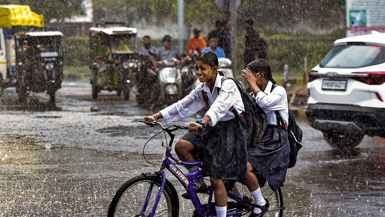
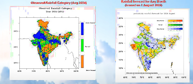
After disastrous floods in Gujarat and a ‘rare’ cyclone in the Arabian Sea, August has drawn to a close with ‘above-normal’ rains over the country – much higher than the India Meteorological Department (IMD)’s initial forecast of ‘normal rains’ for the third month of the monsoon season.
The weather department had forecasted the monthly rainfall to be between 94% and 106% of the long-period average (LPA) – which falls within the normal range. However, it ended at 15% above normal – with excess rains in Gujarat, Rajasthan, Tamil Nadu and parts of Madhya Pradesh leading to disastrous floods in some areas.

“We had predicted the rain to be up to 106% of LPA, but there has been a departure of nearly 15% from that limit. The rainfall has certainly exceeded the expectations. This was largely due to the successive low-pressure systems which continued to bring more rains during the month,” said director general of meteorology (DGM) M Mohapatra on Saturday.
Low-pressure systems are cyclonic disturbances, a regular feature of the southwest monsoon, and responsible for most of the rain. According to the IMD chief, the formation of such systems varies during the season and is not very well predicted in the global climate forecasting models.
“One of the problems while making a seasonal prediction for a month or season is that climate forecast systems globally have a limitation in picking up intra-seasonal variations – like the formation of low-pressure systems. They can very well predict large-scale systems which lead to good rains. But to predict the number of low-pressure/depressions forming during a month is not possible at present,” he remarked.
“One of the problems while making a seasonal prediction for a month or season is such that the climate forecast systems globally have a limitation in picking up such intra-seasonal variations like the formation of low-pressure systems. They can very well predict large-scale systems which can lead to good rains. But to predict the number of such systems (low-pressure/depressions) forming during a month is not possible at present,” he remarked.
CYCLONE ASNA
As many as six low-pressure systems formed during August lasting for 19-20 days against the normal of 16.3 days, out of which two intensified into depressions/deep depressions (advanced stages). One such system gained so much strength that it moved from Madhya Pradesh to Gujarat over several days, and emerged into the Arabian Sea as Cyclone Asna on August 30 – a ‘rare’ occurrence since most cyclones form either before or after the southwest monsoon season. Only three cyclones have formed in the Arabian Sea in August in the last 100 years.
“If we can predict the number of such systems forming every month, or season, then certainly we can address this gap. But it is not possible at present globally, and we are working towards it,” said the IMD chief.
The weather department’s prediction for July rains (normal range 94-106%) also ended on the higher side with actual rains 9% above normal.
NO BREAK IN MONSOON SO FAR
In stark contrast to the initial forecast, there has been no break in the monsoon, with continuous rains over most parts of the country. The IMD had predicted a break to occur around August 8-10. However, this period saw the monsoon trough becoming active and remaining north of its normal position, bringing good rains over northwest and central India. It soon shifted south around August 23-31, causing heavy rains over western parts.
The month also made it to the climate records with the highest-ever minimum temperature (monthly average) recorded by India in the last 100 years. The monthly average minimum temperature was recorded at 24.2 ℃ against the normal of 23.6℃, nearly 0.61℃ above normal for the country. This follows the long-term warming trends over the country in the wake of rising global temperatures.


Comments
0 comment