views
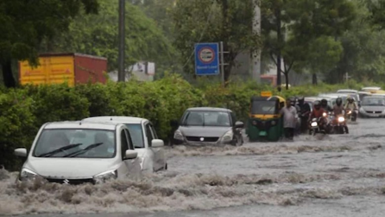
The residents of Delhi-NCR woke up to the third consecutive morning of rain, with moderate showers taking the September rainfall total to 229.8mm till 8.30 am on Thursday. Heavy downpour prompted the India Meteorological Department (IMD) to issue an orange alert.
This is almost twice the monthly normal mark of 125.1mm, with September recording two consecutive days of “heavy rainfall”, said IMD. A Times of India (TOI) report stated that rain is expected to continue this week, with IMD forecasting light rain on Friday.
The last time Delhi received more rain in September was in 2010 — 332.9mm, but through the month. IMD has placed Delhi’s overall rainfall this monsoon in the ‘excess’ category. The rainfall distribution across the capital has been uneven- the North and Central districts having touched the ‘large excess’ category at 112% and 75%, respectively, while neighbouring North East being the only district with a 37% deficit and the capital on the whole is in the ‘large excess’ range.
So far, the North East district has received 368.8mm rainfall as opposed to the normal 582.3mm. The North which has fared the best has recorded 963.3mm rainfall — 112% excess and central Delhi has received 1,020.9mm rainfall as against the usual 582.3mm.
R K Jenamani, senior scientist at National Weather Forecasting Centre told TOI that the distribution of rainfall may vary from place to place and more showers are expected in September. The normal withdrawal date for the monsoon is September 25.
As per IMD rainfall is said to be in deficit when it is more than -19%. Between -19% and 19% is considered ‘normal’ and 20-59% ‘excess’. ‘Large excess’ is when rainfall is 60% more than normal. The capital has received 625.4mm rainfall between June 1 and September 2 as against the normal 484.3mm. While North West and South West districts are in the ‘excess’ category at 49% and 48%, respectively, East, South and West are ‘normal’.
Meanwhile, this time Delhi witnessed ‘heavy rainfall’ days. The weather body classifies rainfall as ‘heavy’ when it exceeds 64.4mm in a 24-hour period and ‘very heavy’ when it exceeds 115.5mm. “Such heavy-to-very heavy rainfall is unusual for September, but has been seen in the past,” a Met official said.
Safdarjung has already received over 200mm in two days and if light-to-moderate showers continue, it could pass the 2010 mark by September-end, the officer added. While Saturday may see a break, showers are expected again from Sunday, until Tuesday.
On Thursday, Delhi recorded a maximum temperature of 32.3 degrees Celsius- two notches below normal.
Water Levels Rising in UP Rivers
प्रदेश के कुछ क्षेत्रों में लगातार वर्षा हो रही है। कुछ नदियां खतरे के निशान से ऊपर बह रही हैं।बाढ़ प्रभावित क्षेत्रों में प्रशासन को आपकी देखभाल, सुविधा व सुरक्षा सुनिश्चित करने के स्पष्ट निर्देश दिए गए हैं।
सजग रहें, सतर्क रहें, बच्चों-वृद्धजनों और पूरे परिवार का ख्याल रखें।
— Yogi Adityanath (@myogiadityanath) September 3, 2021
In Uttar Pradesh, Rapti and Rohan rivers continue to flow above the danger mark, inundating several parts of Gorakhpur city. Authorities are constantly camping to monitor the situation. The Rapti river is flowing at 77.27 meters, 2.3 meters above the danger level of 74.98 meters. Reportedly, the Gorakhpur city areas which have been inundated include Illahibagh, Basharatpur, Badgo, Chiluatal, Chilmapur and Bahrampur among others.
Read all the Latest News, Breaking News and Assembly Elections Live Updates here.


Comments
0 comment